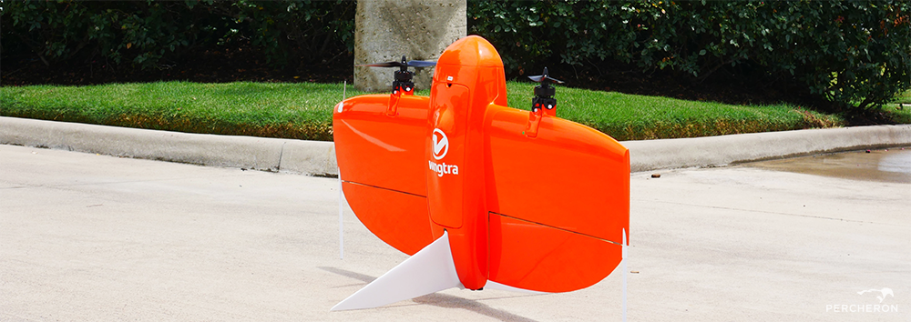
It's a Bird! It's a Plane! No, it's the WingtraOne!
In today’s climate, service companies are tasked with 3 “simple” requests for each project: Fast, Accurate, and Cost-Efficient. Seems “simple” enough……
But with complexities that go along with any land project, the key to truly realizing those 3 “simple” requests: Innovation.
It's a Bird! it's a Plane! No, it's the WingtraOne!
Over the last few years, UAV technology has revolutionized the industries we serve. The introduction of drones has allowed Percheron’s survey team to more efficiently and accurately capture detailed data from pipelines to facility inspections, roadways to electric transmission lines, and renewable energy projects. Our state-of-the-art fleet fly lower and employ higher resolution cameras for video and images than traditional aerial options.
As technology has continued to evolve, Percheron’s UAV team is at the forefront, finding new ways to utilize our drones and provide solutions across all of our service offerings. The latest addition to our drone fleet, the WingtraOne PPK, will provide our team with the ability to be more dynamic and reach further on projects.
What can the WingtraOne do?
2 words: Accurate, Efficient
This drone allows Percheron to map up to 1000 acres (under normal conditions) in a single day while maintaining survey-grade accuracy. Geospatial data collection can be very labor-intensive, but with this addition to Percheron’s fleet, our team will be able to capture the necessary data faster.
Faster data collection = faster data delivery. Increased mapping efficiency due to the drone’s autonomy and long-range capability provides adaptability on projects that are changing in nature.
Why the WingtraOne?
Percheron chose this drone because WingtraOne’s fixed-wing build characteristics enable it to fly for a longer period of time and cover more ground compared to the quadcopters that our fleet previously relied on. Our team is constantly looking for ways to innovate and increase our ability to best serve our clients.
Deliverables?
The primary purpose of this drone will be generating 2d georeferenced orthomosaic maps, 3d point cloud models, texture maps, digital surface and terrain models, and contours lines. With the high-resolution cameras, the WingtraOne is able to fly at a high altitude and still map large areas with a low ground sample distance (GSD).
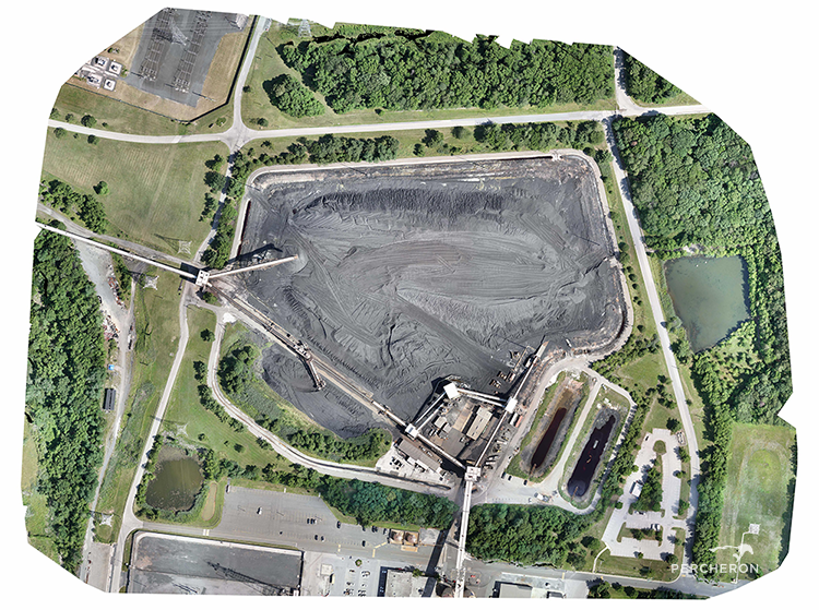
2d Georeferenced Orthomosaic Map
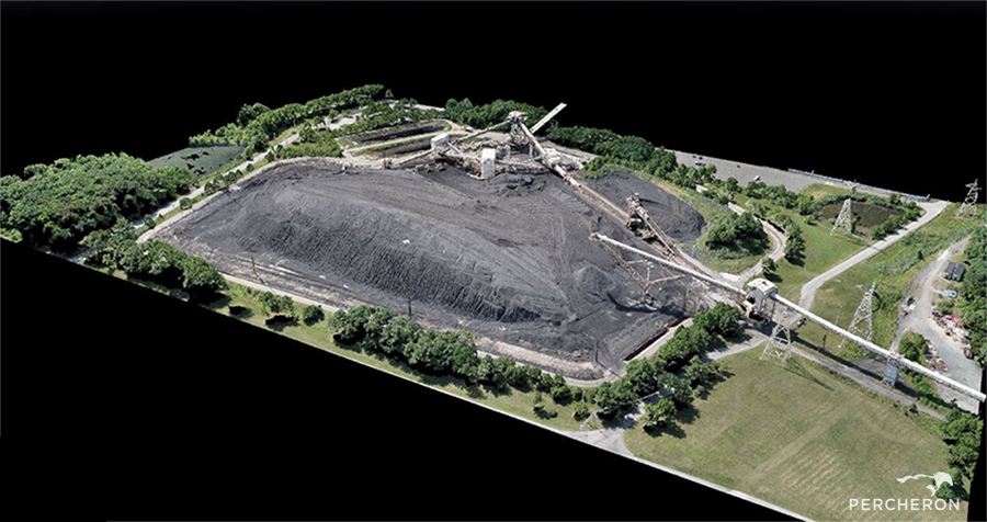
3d Point Cloud Model
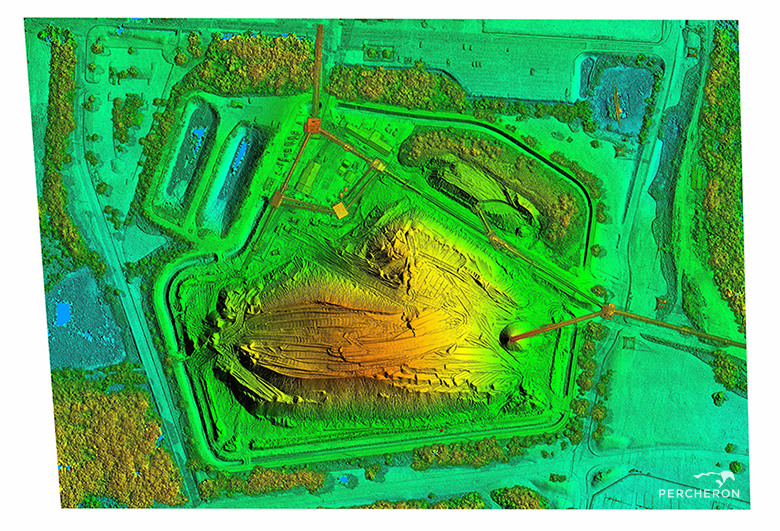
Digital Surface Model
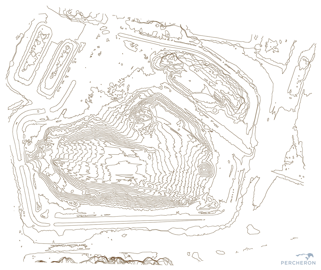
Contour Lines
How can Innovating your fleet help me?
The WingtraOne, combined with our experienced team of GIS technicians, will allow us to efficiently collect and deliver a variety of geospatial data at a much larger scale than previously thought possible. By increasing mapping efficiency and accuracy while significantly reducing time spent in the field collecting data, the WingtraOne looks to be a great asset for the Percheron UAV team.
A truly effective land services company is constantly looking for innovative solutions to completing a project. Want to find out how Percheron’s UAV team can provide innovative solutions on your next project? Give us a call at 832.300.6400 or emailThis email address is being protected from spambots. You need JavaScript enabled to view it. for more information.
 Written By: Taylor Doring, UAV Pilot | Percheron
Taylor Doring is a licensed UAV pilot for Percheron, LLC. He joined Percheron in July of 2018, previously serving as an instrument man for the survey department. Taylor is FAA certified with a Part 107 remote pilot license. When Taylor isn't in the field flying drones for Percheron, you can find him watching sports or enjoying the great outdoors.
Related Posts
By accepting you will be accessing a service provided by a third-party external to https://www.percheronllc.com/