When it comes to project technology to support your land services needs, one size doesn’t fit all. That’s why Percheron offers a cohesive solution for projects both big and small. Percheron has the ability to support your technology needs at all levels.
Land
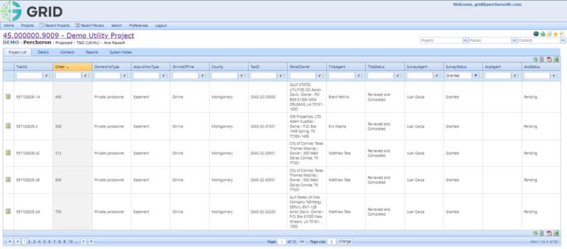
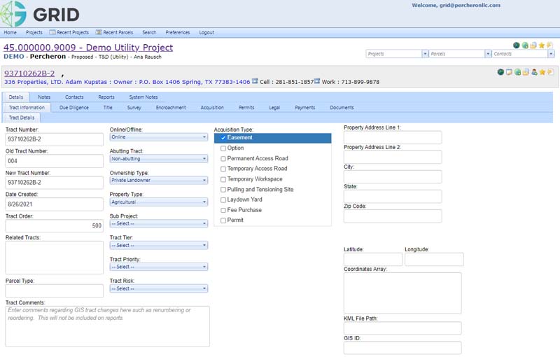
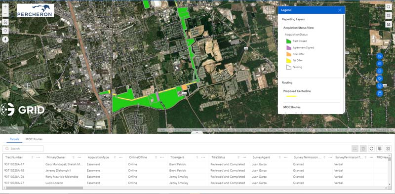
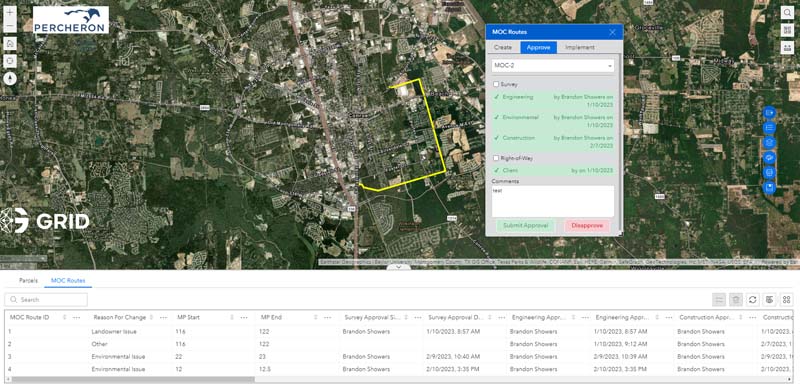
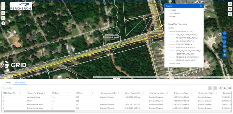
GRID ties together Percheron’s database system (provided by Canyon Digital’s CityVerse) with our mapping system (provided by ESRI’s ArcGIS Online).
GRID Viewer utilizes the ESRI ArcGIS Online Webmap applications, in combination with our database and reporting tools, we can provide a one-stop-shop for viewing, tracking, and reporting.
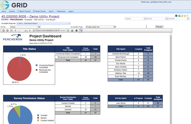
GRID Database, powered by Cityverse, is a web-based database that allows users to assign tasks, manage workflows, and automate document generations. GRID is the perfect solution to create, retain and manage your documents from the start of your project through managing the asset long-term. The database integrates with ArcGIS online to provide project information at a parcel level with various basemap details. Our advanced reporting/analytics tools tie together the data from Cityverse and ArcGIS Online to provide our clients with the most comprehensive view of their projects.
Engineering
The Engineering team utilizes Technical Toolboxes, PIVVOT and Omega PIMS to manage projects, tracking and provide quality deliverables to our clients.
Technical Toolboxes is a leader and innovator for various Pipeline Engineering software solutions throughout the oil & gas sector. The platform houses various software applications that cover the full pipeline life cycle process from conception to design, construction, commissioning, operations, maintenance, and integrity. As with other TT calculations and reports, the HDD Module calculations are accepted by regulatory agencies throughout the US regarding Drilling Fluid Management and Hydraulic Fracture Analysis.
PIVVOT platform streamlines siting, suitability analysis routing and permitting with location intelligence. The platform provides continuously updated data including: boundary, geotechnical, hydrology, land use and property ownership, energy, and infrastructure, jurisdictional, community and society, and ecology. With this up-to-date information, facility siting and utility routing tasks are performed in hours instead of days.
Omega PIMS document control tool allows for each discipline to markup drawings, progress, maintain, save each “layer” or revision of each deliverable. All Percheron employees have access to PIMS, as well as client’s Project Manager to allow update and review documents. PIMS also provides Project Controls overview of the cost, progress and manpower on the project. PIMS utilizes the document progress to develop earned value management estimates.